This article was produced by National Geographic Traveller (UK).
On Santo Antão, silence can strike like a blow. One minute you can be bouncing in the back of a growling pick-up, en route to hike the island’s serrated hills, the next, you’ve been deposited at the foot of a cliff, the taxi has faded from earshot and the world, and all its climatic fury, is muted.
Spend any time on Santo Antão — Cape Verde’s northwesternmost and most mountainous isle — and you grow accustomed to a raucous soundtrack. Adrift in the Atlantic, 350-odd nautical miles off the West African coast, it’s part of a 10-island nation that is as rowdy as it is remote. There’s the thrashing of the ocean, all white fizz and fury. The relentless northeast trade winds, rattling the sugarcane and banana palms. And then there’s the music: melancholic morna, upbeat funaná; guitars in bars, melodies floating from farmhouses and car stereos.
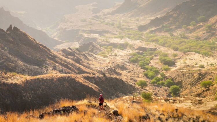
But in those rare moments when you’re sheltered from the gusts, waves and radios, a deafening silence reveals Cape Verde as it truly is: a place out on a limb, held captive by the ocean, a long way from anywhere at all. It’s a long way from popular perceptions, too. When most people think of Cape Verde, they likely picture the flat, blonde-blue shoreline of Sal to the east. Not Santo Antão, an island raw and warped, thrust up and cracked open, variously stark and lush. It’s like a Madeira on steroids, or a tropical Iceland; a rock that seems newly birthed from the Earth’s mantle, still bearing every scar.
Cape Verde has always been a hardscrabble place. The archipelago was, depending on your preference for geology or legend, burped from volcanic hotspots or formed from the crumbs God brushed off his fingers after Creation. When the Portuguese came across the islands in 1458, they found them uninhabited — and strategically located. Cape Verde became a key hub for trading enslaved people, with thousands of unwilling souls bought and sold here each year. Gradually, the population grew, comprising descendants of both enslaved and free Africans, Jews fleeing persecution, and Portuguese and other European settlers. But it was no easy life, with the land and its people mistreated over centuries by both colonial powers and Mother Nature.
Situated on São Vicente island, Mindelo has been built around a natural harbour.
Photograph by Justin Foulkes
When the archipelago gained independence from Portugal in 1975, it was a product of all these things, emerging with a unique Creole culture. Its people officially speak Portuguese, but colloquially Cape Verdean Kriolu. Life is still lived at the whim of the elements, while society is moulded by the not fully translatable concepts of morabeza (warmth and openness) and sodade (longing, to both leave and stay) — the latter felt by those driven to seek work overseas despite loving their homeland. Today, more Cape Verdeans live abroad than in Cape Verde itself.
Thirsty work
I’m here for a week’s hiking in Santo Antão, but, given it has no airport, I start my trip in Mindelo, on the neighbouring island of São Vicente. The port town, built around a natural harbour, was a key Atlantic stop-off for coal ships in the 19th century. A little forgotten now, its brightly painted streets — royal blue, lemon-lime, candy pink — spill back from the crescent bay, backed by bare hills, and still have a pleasing bustle. There are joggers, dogs trotting, fishermen descaling the day’s catch. At the market there are piles of fruit and vegetables — and brief, high-pitched pandemonium whenever a mouse bolts from one of them.
Murals add further colour. Cesária Évora, Cape Verde’s most famous morna singer, born in Mindelo, looms over Praça Dom Luís, her image covering the side of the library. But there’s street art everywhere here — piano keys and musical notes climb up to the rooftops, faces smile from shopfronts, sea creatures swim across rendered walls.
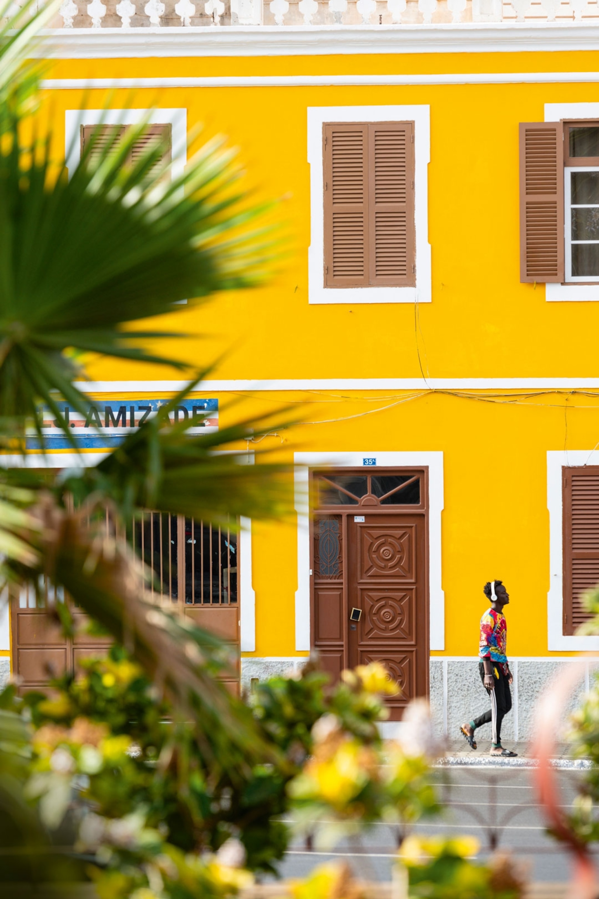
The port town of Mindelo is known for its brightly painted streets and bustling atmosphere.
Photograph by Justin Foulkes
It’s a vibrant introduction. But, after a night in Mindelo, I’m up early the next morning to make the short ferry hop over to Santo Antão to start following the island’s less-explored trails. The boat docks and a taxi takes me to the east coast settlement of Pombas, following a bleak road sawn through desiccated terrain. As soon as I start inland, on a five-mile hike along the now dry Ribeira do Paúl, the world erupts into technicolour. The valley is Cape Verde at its greenest, overspilling with sugarcane and bananas, manioc and yams, dragonflies and egrets. Nowhere is flat by nature — it’s all angles, outcrops, rock ribs and ridges — but somehow villages cling on.
The trail through the valley to the ridge-top hamlet of Pico de Antónia is all up, but I enjoy the climb, following a quiet road at first, which weaves from the ocean and up into the hills. Soon, in the dry riverbed to the side, I pass a man with muscles like an Ancient Greek hero, who’s sifting pozzolana (volcanic ash) to be used for cement-making. Another is busy cracking fresh almonds with a pick — he hands me a tiny nut as I go by. Then, as I swap roads for trails, I see farmers bent double on the edges of stone-walled terraces, pulling up pungent spring onions. As I venture deeper up the valley, it begins to resemble a living Machu Picchu, with stepped fields rising higher and higher up the hulking peaks.
As I’m looking up at all this, a lady skips easily down the slope towards me. Red scarf wrapped around her head, Jesus gazing out from the front of her T-shirt, she shouts her name, Alcinda Fonceca, entreats me to stop at her cafe when I reach it, then dashes off again. This dedication to touting for business on steep mountain paths deserves reward, I think. So when, 20 minutes later, I finally arrive at Alcinda’s place — one of a handful of precipitous houses that makes up Pico de Antónia — I order a coffee on her veranda. From here, bony shoulders of land shrug upward, while terraces cascade below. Alcinda motions across the valley to point out the coffee bushes where the beans in my brew came from.
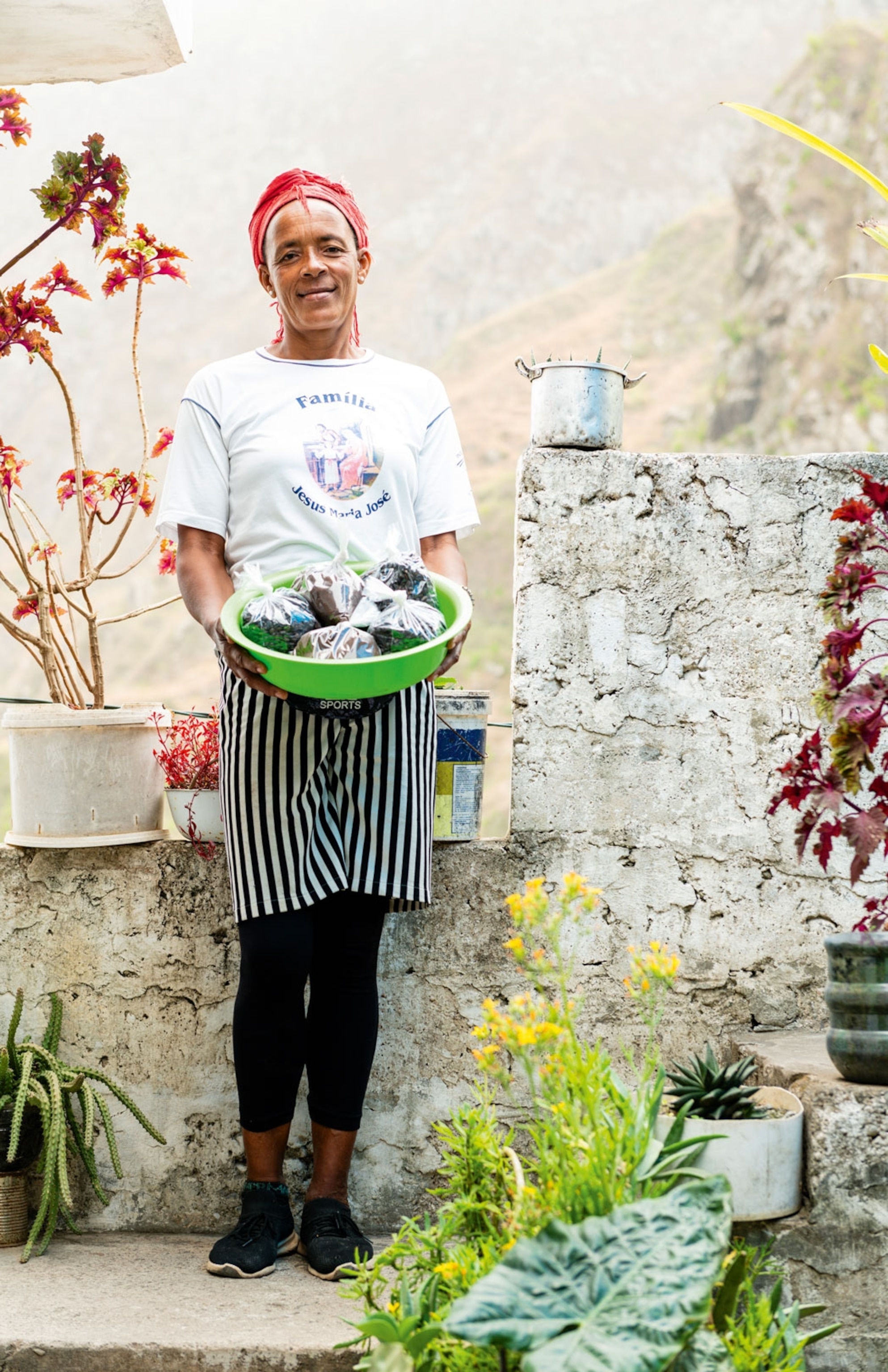
Within the Pico da Antónia hamlet, chef-owners can be found serving coffee sourced from the valley’s own coffee bushes down below.
Photograph by Justin Foulkes
My walk finishes at O Curral, a barn-cum-bar in the village of Chã de João Vaz. Here, where most of what’s sold comes from the owners’ fields. This includes homemade juice, cheese and grogue (rum distilled from sugarcane). The latter has been produced on the islands since the Portuguese first arrived and is now Cape Verde’s national drink. Most of the country’s grogue comes from Santo Antão, with the best said to originate in the town of Paúl. It’s only mid-afternoon but, with the sweet scent of cut cane floating on the breeze, it seems rude not to try one — especially at 150 escudos (£1.15) a slug. With the mercury hovering around 26C all year, hiking in Cape Verde is thirsty work — made all the harder by strong and consistent wind and sun. I sip the clear liquid, which is surprisingly smooth but strong as iron; my head immediately swims.
That evening, in Ponta do Sol, I try it again. The old town, sprawling on a peninsula at the island’s northern tip, has a handful of bars dotted along its wide, cobbled streets; I’ve bagged a table at Cantinho da Música, where owner Jaqueline Santos opens her roof terrace to a lucky few.
I order a glass of xtomperod (grogue mixed with pontche, a honey liqueur) but there’s no food menu to choose from; only one dish is served at each sitting, and tonight it’s grilled fish with fried cassava, rice and beans. This is accompanied by a man with a guitar playing soulfully in the corner. He’s built like a bear (he’s the local sports coach, I learn) but sings like a seraph. Everything — food, drink, vibe — is so inviting that I find myself joining the singalong despite not knowing the words.
Reyder dos Santos notices my efforts. A local hiking guide joining his French clients at the cafe, he tries to give me the general gist. “The song is about a woman selling fish,” he says, “but also much more — it’s a symbolic thing.”
“Music is so important to us; it’s like what you eat,” Reyder continues. “And this island, it’s music, food, mountains more than materialistic things. I left to study overseas but always wanted to come back. My heart will always be here.”
The very harshness of the land seems to engender a deeper connection to it; the emotional push-pull of sodade. I sip my xtomperod and keep singing.
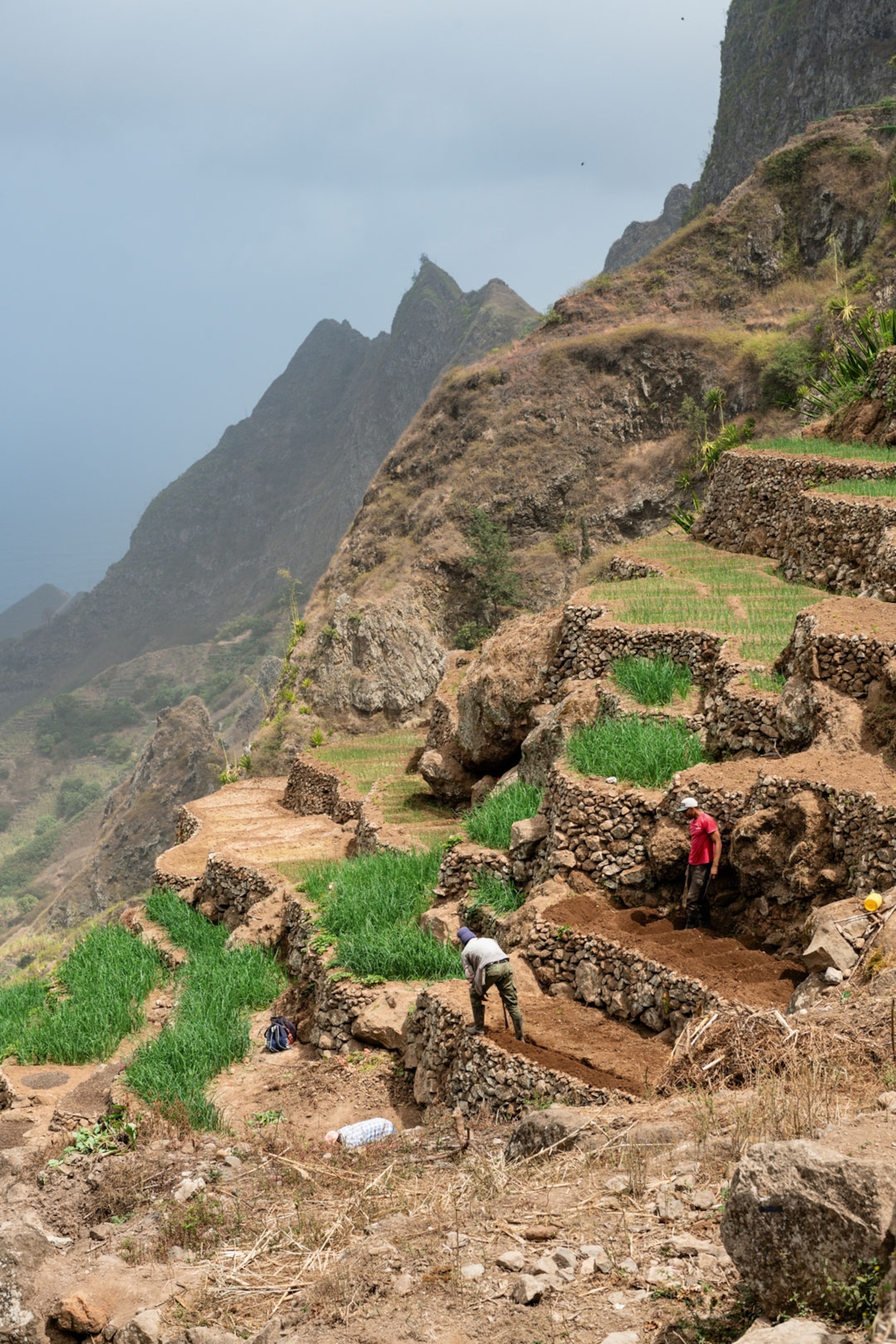
Farming in the valley is no easy task, having to work stone terraces on the steep slopes.
Photograph by Justin Foulkes
Up in the air
Aside from music, walking is the best chance an outsider has of sensing this deeper connection on Santo Antão. “We love to trek,” confirms Herminia Ramos, a teacher from Pombas whom I get chatting with in town. “Although sometimes it’s the only way to get around. There are still villages that have no roads.” Some of her students walk two hours to school and back each day, she tells me. Now, the trails used by locals for centuries are drawing handfuls of hikers like me.
I’m staying in Ponta do Sol at B&B Coração, built from local stone by Belgian expats Wim and Hilde Van Belle-Van Gelder. My room has a balcony looking across an abandoned runway to the ocean. Since the airstrip closed following a crash in 1999, a ferry has been the only way to reach Santo Antão — although there are plans to open a new airport west of Porto Novo in the hope of bringing more tourists.
Today’s nine-mile hike is to the fishing village of Cruzinha, west along the coast. I start from Ponta do Sol’s main square, with its yolk-yellow town hall, whitewashed church and waving palm trees, then begin to hike the steep path out of town. The route snaking ahead is clear, solid and substantial — wide enough for mules. Yet it seems an impossibility, somehow snicked into the gravity-defying cliffs that plunge in the distance towards the frothing ocean far below.
Before too long, I spy the cliff-clinging village of Fontainhas, a jelly-bean-hued cluster of houses balanced on a perilous spine, jutting high above the deep valley’s folds and lush terraces. Herminia had told me it has “one of the most beautiful views in the world”, and I can see what she means. The authorities would also concur: a board in the village square announces big plans for Fontainhas, including improved road access and the safeguarding of its local heritage. I stroll through the village and pray that the former doesn’t impinge upon the latter — although you can’t begrudge the residents for wanting an easier life.
It’s a stiff climb up to the col separating this coastal valley from the next, and I arrive to find a fragile blade of rock that seems in danger of being felled by the wind. The snaking descent from here to the isolated hamlet of Corvo, via a cobbled trail, is punctuated by the 14 Stations of the Cross, depicting the events of Jesus’s journey to crucifixion. I note each one as I go, but mostly stare out to sea. Wim, at B&B Coração, had told me to keep an eye out for turtles, dolphins and whales: “All different whales. If you see a ‘pschew!’, you’ve seen whales,” he’d said, imitating the sound of a spout. I stare hard. There’s a brown shape that might be a turtle — loggerheads, in particular, frequent these waters — but the sea is like a herd of white horses, making anything else hard to discern.
A little further on, I stumble into Aranhas. The name means ‘spider’ — apt for this now-abandoned village, given over to insects, milkweed and Iago sparrows. The ruined houses, some still standing, some slumped and spewed, are blending into the surrounding valley. Incredibly, amid this formidable landscape of rumpled rock, I can still make out the former agricultural terraces, likely unfarmed for decades but enduring still.
Waiting for the rain
My final walk, two days later, is an eight-mile loop along the Ribeira das Patas, on the island’s southeast coast. Early-morning sun is sneaking into the wide valley’s dark, dry fissures as I stare at the fearsome Bordeira do Norte, a seemingly impenetrable wall of rock. But, somehow, there’s a track, and I’m soon zigzagging up sheer slopes of volcanic sand and stone, inching along dizzying precipices. The valley spreads below, the sea is lost to the haze beyond. To one side, clouds surge over the Alto Mira pass like a tidal wave; to the other, the path scrapes across rock streaked with shades of orange. It’s only thanks to a set of figures on the trail in the distance — farmers leading donkeys — that I can make out which way I’m supposed to go.
The route continues past formations of granular pumice stone, through a small canyon and into a scattered community, where a few souls work parched terraces growing beans and corn. It’s here I meet Juan Bautista, who’s tending to his donkeys: one brays a welcome, another rolls gleefully in the dust. Juan is keen to chat and, although I don’t understand his Kriolu, he conveys a little about his life. He shows me his simple house, the herbs he brews into tea and the corn he’s harvested. As he speaks, two kittens chase wind-blown husks in the yard. These are Juan’s day-to-day companions. Through snatched words, sign language and deduction, I work out his family, including three children, live elsewhere on the islands.
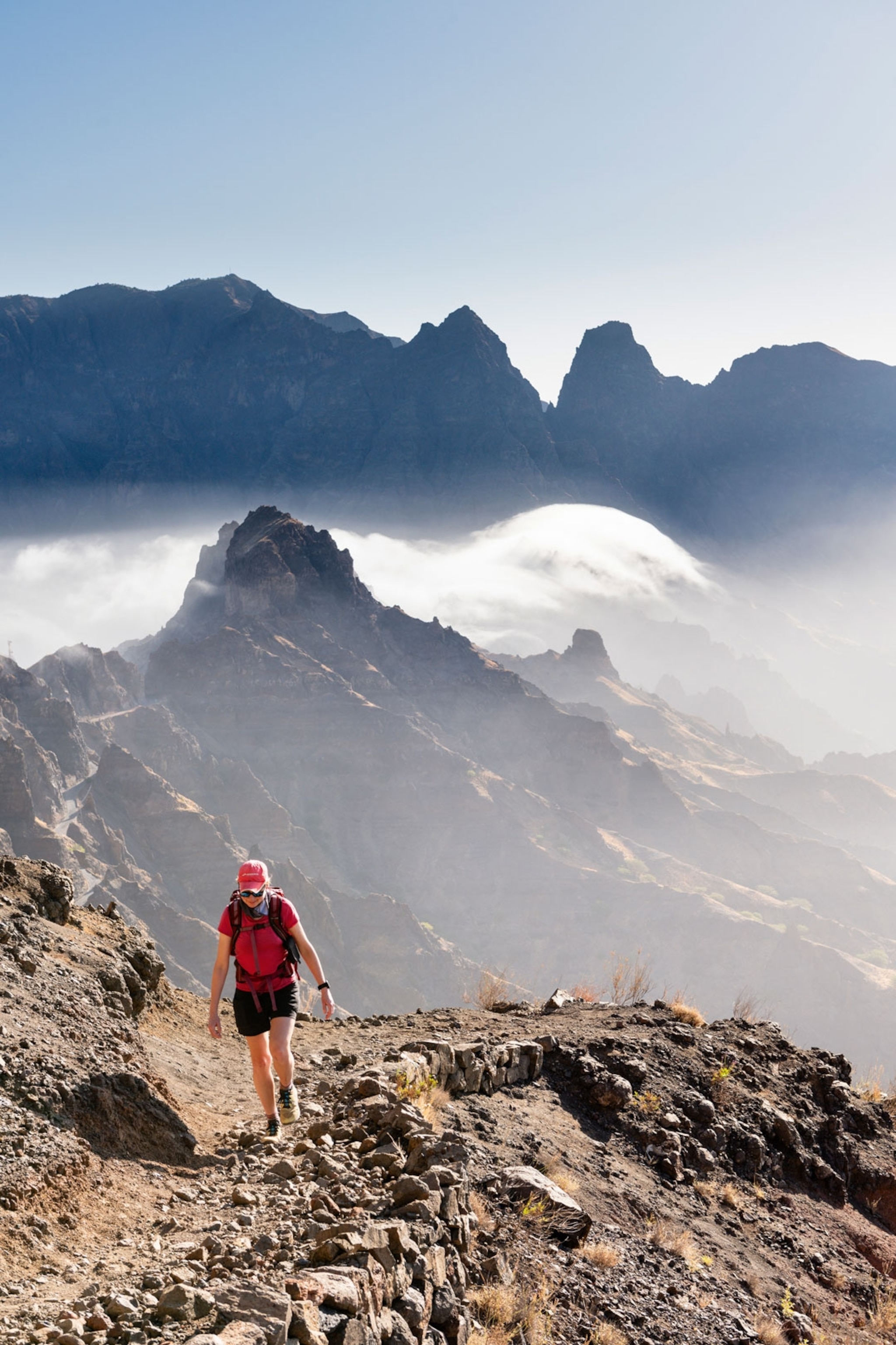
Views over the Patas Valley and surrounding peaks become lost in the haze upon climbing the Bordeira do Norte cliff face.
Photograph by Justin Foulkes
This lunar-like landscape of crusted lava flows and dry riverbeds, with views across to 6,493ft Tope de Coroa, Santo Antão’s highest peak, makes good hiking country. But life here can be harsh. The islands of Cape Verde can go for very long stretches without rain. In the 1940s, around 45,000 people — equivalent to the entire population of Santo Antão today — died as a result of drought; thousands more were driven to emigrate. A classic of Cape Verdean literature, Manuel Lopes’s 1960 novel Os Flagelados do Vento Leste (‘The Victims of the East Wind’), describes the struggle of surviving in this very valley when the rains don’t come. Lopes, who lived in Ribeira das Patas for some time, wrote about the steep, hairpin path along which I’m hiking, which connects the uplands to the valley; the treacherous route was heavily used by locals during the famine-ravaged years.
I leave Juan and climb to the dizzying viewpoint, with its wide-angle view over the Patas valley, where dark volcanic crags police arid river channels that run waterless toward the sea. I then descend via that very path, slaloming down the face of the Bordeira do Norte. To walk it now, guesthouse and cold Strela beer waiting below, is thrilling. To trudge along it daily to watch over crops that won’t grow is unthinkable.
The next morning, I catch the ferry back to Mindelo for one last night in Cape Verde — and the relative cosmopolitanism of the town feels almost bewildering after my last few days spent hiking in the wild. As I nurse a final grogue at La Scène M, a cool courtyard music bar twinkling with fairy-lights, my mind drifts back to Juan Bautista high up on his plateau; I hope the rains will be good this year.
On the bar’s low stage, a lady steps out and begins to sing a slow, haunting tune. It sounds filled with love and loss, though, of course, I don’t know any of the words. But maybe that’s as it should be – it’s something only a Cape Verdean can truly understand.
How to do it:
Walks Worldwide has a new eight-day self-guided Hiking Trails of Cape Verde trip from £769 per person, including B&B accommodation in traditional hotels and guesthouses, picnic lunches, most dinners, walk notes, private transfers and ferry tickets. Excludes flights.
Getting there & around:
The nearest airport to Santo Antão is on Cape Verde’s São Vicente island. TAP Air Portugal flies there from London or Manchester via Lisbon. The average flight time is 6 hours and 30 minutes. The ferry between Mindelo (São Vicente) and Port Novo (Santo Antão) takes one hour. Both islands can be explored on foot. For longer journeys, use taxis or alugueres (shared minibuses), which leave when full and can be flagged down on the roadside.
When to go:
Cape Verde is warm year-round, with average temperatures consistently ranging from 24 to 30C. The wind is strongest November to March; the bruma seca — when Saharan winds can cause a sandy mist — is most likely January to February. The climate is very dry, with only a short monsoon season from August to October.
Where to stay:
B&B Coração, Ponta do Sol. From 10,248 escudos (£80), B&B. Residencial Raiar, Mindelo. From 4,400 escudos (£34), B&B.
This story was created with the support of Visit Ras Al Khaimah.
Published in the Jul/Aug 2024 issue of National Geographic Traveller (UK).
To subscribe to National Geographic Traveller (UK) magazine click here. (Available in select countries only).
Source link : https://www.nationalgeographic.com/travel/article/hiking-heaven-cape-verde-africa
Author :
Publish date : 2024-07-23 14:26:45
Copyright for syndicated content belongs to the linked Source.

